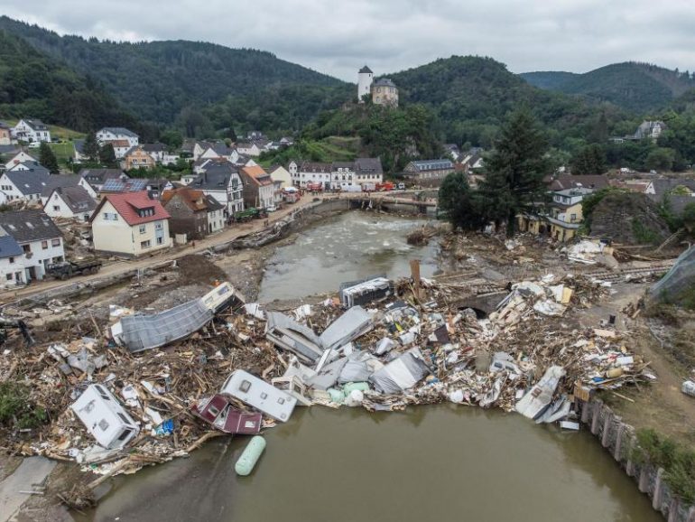
HAMBURG (DPA) – The rainfall forecast before the flood disaster in July was very good, according to the German Meteorological Service (DWD).
At the Extreme Weather Conference in Hamburg, the director of climate and environment at the German weather service, Tobias Fuchs, said the challenge was to predict where the exact amount of water would flow. Fuchs demanded that meteorologists combine their models more with the models of hydrogeologists.
In early August, an international team of researchers coordinated by the DWD came to the conclusion that climate change had increased the likelihood of such disasters from 1.2 to 9, Fuchs said. The rainfall intensity has increased by 3 to 19 percent in the tested areas. The team looked at France, West Germany, eastern Belgium, the Netherlands, Luxembourg and northern Switzerland. “So we see that the heavy rains this year had the fingers of climate change,” the meteorologist said.
The meteorologist said that based on long-term region-wide data from 51 weather stations, the DWD could not determine any clear change in the incidence of heavy rain in Germany. The number of days with more than 20 liters of rainfall per square meter changed only marginally between 1951 and 2020. However, the radar-based assessment showed modest signs of growth. From these, it can be inferred for some areas that the frequency of heavy rainfall is increasing. There has been an extensive weather radar network since 2001. But 20 years is too short to be able to deduce strong climate trends from the data.
In mid-July, a flood disaster devastated entire regions in North Rhine-Westphalia and Rhineland-Palatinate. So far around 190 people have died and many people are still missing. The Extreme Weather Congress seeks to inform the public about the state of climate research and draw attention to the consequences of climate change. It is conducted by Hamburg meteorologist Frank Böcher.
© dpa-infocom, dpa: 210922-99-314564/5

Web guru. Amateur thinker. Unapologetic problem solver. Zombie expert. Hipster-friendly travel geek. Social mediaholic.


